Category Archives: Wanderings

Café Snowdon

Note: This entry has been restored from old archives.

Café Snowdon!
Café Snowdon!

This could be an interesting theme: climb mountains and make espresso at their peaks.

Late on Friday August 7th we drove off for Wales, leaving home at 17:00 when I wanted to leave at 16:00. Always last minute things to do! The 209 mile drive from Hitchin to our destination was fairly uneventful, the lowlights being a bit of slow traffic on the M1, and being tailgated by arseholes on windy Welsh valley roads (who end up going even slower when I drop 20 miles per hour because I have an asshat in a Land Rover shining his lights straight through my back windows at point blank range.)

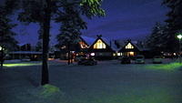
Our destination was the Hafod-y-llan National Trust campsite, luckily Mr Land Rover was going to the cityfolk campsite at the other end of the lake. By the time we got there it was dark, certainly dark enough that torches were required to put our little tent up. Alas, we’d only packed one instead of the two we should have had. After wandering the little camp ground for a bit we settled on a clear patch on a bit of a slope, we’re quite happy with slopes really. A nearby camper kindly lent us his head torch and we were all set up in 10 minutes. After some more fiddling we eventually got to bed at 23:00.

Hafod-y-llan
Hafod-y-llan

It was a slightly rough night of sleep for two reasons. First, I’d worked out how the ends of the tent could be adjusted to improve airflow – I, perhaps, “improved” the airflow a bit too much. The idea being reduction of condensation. The two of us cause quite a lot of this over a night, it is almost as if it somehow rains on the inside of the tent. Our tent is a dual-skin though, so this causes only minor difficulty in the morning. I wipe down the inside of the door with one of our chamios-like micro towels. If we’re to pack up or tents that day, as we were every morning on our Lakes hike, we then combine our efforts, and towels, to towel down the entire inside (and then the outside if it has rained.) Though this seems involved, it really doesn’t take all that long. One of the prices you pay for putting two people in a very small tent perhaps.

The second reason was that we’d unthinkingly let Yaël traipse off with one of our sleeping bags (for a friend she was travelling with.) On the day we were to leave we realise this, oops! So we had one sleeping bag between us, unzipped to be used like a blanket. It wasn’t too bad in the end, but not ideal.

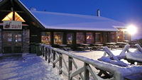
We got up nice and early in the morning, 6AM for me. And prepared to trek off. Putting the bits we wanted for the day into Kat’s pack, which I was to wear. And a few items of food into a micro pack we have for Kat. Kat’s pack doesn’t fit me too well, but it is fine when the weight is only about 6 or 7kg. To begin the day we wandered down the driveway of the campsite to Bethania, where the Watkin Path up Snowdon begins, and where there also happens to be a Café. The café opened at 08:00, 10 minutes after we got there, so we waited. The café is huge, an old chapel in fact. It was bought by a group of locals I’ve read, and converted to its current use as a place of refreshment. Alas, their espresso is terrible, but that is no surprise. At 08:30 we were on the Watkin path, on our way to Snowdon’s summit.

By Afon Cwm Llan, Looking back down the route to Nantgwynant

At first the Watkin path is a leisurely stroll through woods and fields. Passing some intriguing old stonework. Essentially some very straight and raised paths down steep slopes. You’d think they’re old train lines, except that they’re very steep and don’t seem to take logical routes as compared to other train lines in hilly regions. One cuts straight up a buttress of Yr Arran, following a gradient reminiscent of a rollercoaster ramp. Funny place for a rollercoaster though! Some research reveals that these are the paths of slate inclines, and that this one, in fact, was never completed.

Incline
Incline

Passing this puzzling sight we’re on an impressively paved stone path up the valley of Afon Cwm Llan. This is a beautiful watercourse, given sunlight and a few degrees more warmth I doubt I could have resisted going for a dip in one of the many spa-sized pools of crystal clear blueish water (is it blueish due to the copper in these mountains I wonder?) The path passes some interesting stone buildings at a narrow point in the valley, some sort of fortification perhaps? Fortifying what though? The old ‘net is littered with references, the closest fitting of which is that it could have been the residence of the master of the slate mine.

There are a few more buildings along the path, as it makes its way up the valley. Finally there is a long one with a track heading out from it which loops around and forms a well defined road-like track on the other side of the valley. We wonder if this links up to the crazy-steep line on the other side of that ridge. An engine house of some sort perhaps? (I’m going to have to look all of this up when I get home. No Internet in the middle of a field in Wales!) Now, much later, I can look this up and it seems most likely that the long building is the barracks which housed the slate mine workers during the weekdays. The slate mine itself is said to have only operated for about 40 years, the slate there being of low quality. Modern evidence of this is said to be visible in how overgrown with grass many of the old tailing heaps are. This indicates that there was much dirt dug up with the slate, which isn’t at all good I take it. I presume they kept going in the hope the dirt would go away … but eventually hope, or money, ran out.

Barracks - home of slate mine workers during the week
Barracks – home of slate mine workers during the week

After passing the “engine house” the path becomes steeper, though still well paved. The stretch up the side of the valley is the most picturesque leg of our hike. Views above, views below, and since we aren’t in the clouds yet, views for miles around. We can even see the coast from up here. Plus, there are goats, goats with huge horns, goats cannot be beaten.

Bwlch Ciliau, Y Llywedd behind us

Rough stone steps take us up to the top of the ridgeline, Snowdon’s buttress out to Y Lliwedd. This is Bwlch Ciliau, where the path flattens out and follows the ridgeline over Bwlch Saethau. (Note that, this being Wales, I can only guess that the names near peaks and valleys are actually names I can apply to said peaks and valleys!) The walk along this ridge provides for some excellent photos if you follow one of the minor tracks off to the right. You find yourself at the top of a huge cliff looking down on Glaslyn, it is an excellent view for a photo.

On Bwlch Saethau, Glaslyn far below

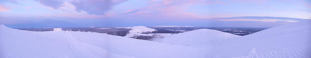
The ridge takes you from about 750m to the 825m mark, where the going gets tougher. The route turning into quite a scramble as you make it up the final 200m to the peak. By the 800m mark we were in cloud, so just like our Scafell climb the summit looks like it won’t be giving us much of a view. A little sad, I cross my fingers and hope it’ll clear before we descend.

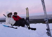
The last 50m of ascent is something of a stroll. It is all a little strange, we begin to hear the chuff-chuff of a steam engine, and soon a large building looms out of the fog. Then we hit the people… it is like a shopping mall. We skirt the building, past people clustered around the building entrance sucking on fags, looking a lot like they would rather be elsewhere. Fathers and husbands dragged along for the ride perhaps. Then we’re there, a short stone platform with two sets of stairs and the trig-point at the centre. It is crowded with people.

More than one use for coffee!

We wander around to the more sheltered north eastern side of the platform, using it as a wind break. Not bothering to venture to the top in a hurry, we can wait for a break in the crowd. I get out my little meth-burning stove and fill-er-up. We almost had a major disaster on this trip, I forgot to bring fire. I use a flint to light the stoves, which is a case of lighting either meths or wax-impregnated card (Hammarö paper.) It works surprisingly well. Unfortunately it didn’t come with us! We were somewhat lucky that the café at the bottom of the Watkin Path sold lighters and matches, so I bought a lighter. All hunky dory now right? No. I don’t have a lot of experience with lighters, and didn’t realise how crap your typical lighter is. This one doesn’t like to light if there is anything so much as a breeze, it lit inside the café just fine, which is the only place we tested it. On top of Snowdon all it would do is spit a few sparks, not good enough to light meths. So I had the smart idea of applying an old trick from when I was a kid, adjusting the +/- wheel so that the + was even more +! As soon as I took the silver shield off the lighter the wheel fell out and it was only by luck that the little bit of flint was jammed and didn’t fly off. Now I had to get the flint back down the little hole, compressing the spring. This is hard to do at the best of times, but with numb fingers close to impossible! With the aide of the tweesers from Kat’s pocket knife I put it back together… after 15 minutes and almost losing the flint twice! I extra-plussed the + and we were soon back in action!

One more step back... Enjoying espresso at Snowdon's summit
One more step back… Enjoying espresso at Snowdon’s summit

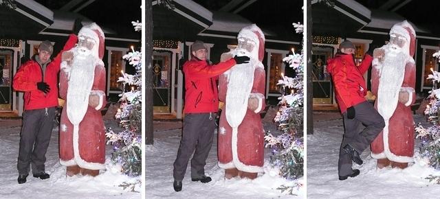
Café Snowdon espresso was enjoyed, we even made second shots. At least this amused some of the multitude of people up there. Including a couple of guys who were enjoying some beers they’d brought up with them (on foot, not by the train, so respectable in a way especially as one of them had brought both pints up as a surprise for the other.) They took some photos for us and we took some for them. We took some photos on the trig-point platform as well, though I now realise I never even bothered to look at the plaque on the trig point.

Next, Kathlene keen on some hot food, we headed for the actual café that is up there. We squeezed in, it is a huge space so having to squeeze indicates how packed the place was, then immediately I turned around and squeezed out. Insane! Horrible! I promised Kat we’d find some hot food after our descent and we began our downward route. Alas, the cloud never cleared.

Looking down the Pyg Track, Glaslyn afore, Llyn Llydaw aback

I’d worked out a full circular walk in advance. After the hard trek up the south side of Snowdon we were to take a more leisurely route downhill to the east, before following the valley south west and back to the camp. This begins by heading north from the summit and then east down the Pyg track, before descending onto the Miners’ track which runs alongside Glaslyn and Llyn Llydaw.

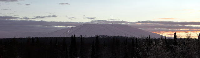
Talk about busy! This route was a bumper-to-bumper highway of human traffic. Very frustrating at times as most of them make their way along the track very slowly and there are several stretches where overtaking isn’t possible, and waiting for oncoming walkers is necessary. Aside from the difficulties posed by the popularity of this route it provided some wonderful views. Most of the time the view down the valley over the lakes is present, and all the time the steep walls to the north and south loom overhead. From the shores of Glaslyn we could see the spot where we took the photo of ourselves on Bwlch Saethau with Glaslyn far below. On the western side of Glaslyn towering cliffs running straight up to the summit of Snowdon, lost in cloud, dominate the scene.

Looking up to Bwlch Saethau we took our photo looking down on Glaslyn from the V in the ridgeline

The route along Glaslyn and Lyn Llydaw is flat and wide, allowing you to focus more on the scenery than where you’re putting your feet. As with much of this countryside there are ruins littered around the landscape which intrigue the mind. In this area most of these high ruins are mining related, generally either slate or copper. By Glaslyn and, further down the track, Llyn Teryn are the remains of miners’ barracks. While, most impressive, is some sort of mine working building on the shore of Lyn Llydaw.

As you make your way along the lakes you pick out other remains, some foundations and what seems to be the line of an old raised railway. There is a causeway cutting across Llyn Llydaw then a more modern structure which is presumably a valve house feeding the large pipe running down the valley (this, it turns out, feeds a small hydro power station in the valley which was built in 1908 and is still put into operation when required.)

Copper works by Llyn Llydaw

The rest of the walk to Penn-y-Pass continues to be straightforward and before long you find your self at an ugly car park. There isn’t much here, I had hoped for a nice little pub, but there is just a caf which can do you a solid hot meal. From Penn-y-pass you could catch a bus back around to Bethania, but we did the valley walk.

This home stretch took us down Afon Trawsnant, then Afon Glaslyn. From not long after Pann-y-Pass to well past the power station this path is very wet. Good high boots with reasonable waterproofness are highly recommended! The path takes you behind the veritable metropolis of the fancy campsite to the north-east of Llyn Gwynant, then on behind the lake itself. The walk behind the lake takes a fairly high route and provides for some excellent views down over the lake. This was also the best area for us to gather sticks for our excellent little Bush Cooker, my pockets were soon bulging with nice dry wood.

Dinner time! Mmm... fire
Dinner time! Mmm… fire

A few fields later we’re back at the Hafod-y-llan campsite. We’d set out at about 0800 and got back at 17:00, with at least an hour’s worth of stop time along the way. Our 17:00 return gave us plenty of time to chill out, make some coffee and dinner, and relax. Quite an excellent day all up.

We’re calling this walk the Devil’s Circuit… I do hope you can see why.

Devil
Devil

Our path took us up quite a steep route, which was clear and well paved all the way to Bwlch Saethau. The final ascent towards the summit became quite loose and confused at times, with hands being required at some points. I can see why this route is considered quite dangerous in winter. At one point you’re traversing a scree slope that ends with a cliff, imagine it covered in ice and snow! One way ticket to splat. The summit of Snowdon is very civilised, too civilised really. Scafell Peak wins any summity goodness competition hands down.

We will go back, but in the off season, when the train isn’t running… hm, perhaps I should get some ice axes and crampons for that one 😉 Meanwhile, I’ve been playing with generating SVGs of these walks, the most interesting of which is elevation over distance covered.

Snowdon Walk – Elevation over Distance
(click here for a larger version)

If you can’t view SVGs (i.e. you use a retarded web browser like IE) then you won’t see the image above. If you care… use Firefox (and no, I don’t think Firefox is great, I think it is a pile of crud.)

Stour Valley Path

Note: This entry has been restored from old archives.

Across the Stour Valley

In order to test out all our new Lakes District hiking gear we went for a nice long walk last Saturday. Since we also had a desire to visit Colchester I combined the two by picking up a hire car and choosing part of the Stour Valley Path as our walking ground (just to the north of Colchester.)

Things kicked off on Friday night really, as we packed the core items into our packs. We were aiming to carry what we’ll be starting with on the Lakes expedition. This meant clothes for a week; actually just 2 changes of base layers, one change of a couple of mid layers, and a windshell. Trying to keep it light! Major weight factors are water (which diminishes through the day of course, I start out with 3.5kg of the stuff) and food (about 4kg), followed by tent (1kg), and sleeping bag (0.8kg.) In the end my pack weighed about 20kg. I did also carry my Asus EEE, which is more than a 1kg – I’ve almost decided that carrying a laptop through the Lakes would be really silly 🙂

We drove to the Rushbanks Farm campsite, which is near Wissington and right on the banks of the River Stour, and started walking pretty much straight away. Leaving assurances that we’ll be back in the evening to the somewhat bemused camp warden, or whatever you’d call him, who must have been wondering why we were trekking off with huge packs on. (Note on the Rushbanks Farm site: it is clean and well maintained, though because of its small size you’ll always be close to the neighbours. The price of camping there seems steep, it is based on the number of tents you have and is £9 per tent. Quite annoying given that we had two tiny ultralight tents, so would have paid twice what a family near us with a massive mansion of a multi-room tent would have paid.)

We walked solidly for about 4 hours, getting us along 15km of the Stour Valley Path. The path itself, this part at least (there’s 60 miles of it in total) was a little dull, with just a couple of short stretches actually near the river. In the map above you can see our route, most of what is north of the river is the Stour Valley path, the point where it crosses the river to the right is our 4-hour mark (halfway), where we sat on a small patch of grass for a rest.

Unfortunately, by this point I had the most appalling headache, and was feeling mildly nauseous. We can only put this down to me having had no caffeine for 24 hours, pretty typical withdrawal symptoms my sister tells me. Great, 24 hours without coffee leaves me in a state of debilitating pain (it was one of the worst headaches I’ve ever had.) As is probably obvious, I never go 24 hours without an espresso. So a couple of choices for the Lakes: take coffee, or go cold turkey. I haven’t made up my mind on this, but I have to admit I’m somewhat disturbed at the side-effects of this lack of coffee. Might need to reassess my coffee drinking habits (again.)

I grinned (well, grimaced) and bared it. No choice really, we still had to get back to the camp. For the route back I chose a quicker stroll along the Essex Way and some roads (including the amusingly named Burnt Dick Hill.) We rocked up back at the campsite at about 18:30, 8 hours after we’d set out. All up we’d covered just under 26km, or 14 miles (I prefer the sound of 26km personally!)

Setting up our tents was a snap, just a slight issue with the ground being very hard (held the pegs firm at least!) Then, while I rolled around in agony in a tent, Kat and Yaël wandered off to gather some dry sticks and twigs for dinner. The sticks and twigs feed our little Bush Cooker wood-gasification burner. The BC is a little beauty of a device, boiling our 600ml of water in a few minutes. Lit with a flint and steel and a bit of Hammaro paper (just half a segment is enough), a couple of big handfuls of sticks will boil a couple of rounds of water. Leaving nothing behind in the burner but the finest of white ash. Most impressed!

We ate our cous cous, had a hot chocolate, then headed to bed at about 10:00. Being in the middle of a field, it was still quite light even this late. Thanks to our walking I don’t think any of us had any real issues getting to sleep, despite the campsite being rather noisy.

Waking up was easy the next day, thanks to it getting light before 5. There had been a heavy dewfall but we were all dry inside our tents. The tent Kat and I were using had collected a lot of condensation inside the fly, not surprising a it is quite a small space for two. The inner tent was entirely dry however and protected us from brushing against the wet outer. We opened the tents up a bit in the hope that they’d dry out while we sorted out breakfast.

Our breakfast for the trip is a high-calorie muesli, eaten with milk reconstituted from a powder. Quite tasty actually, and on this morning I heated some water so we had warm milk with our muesli.

After breakfast we started packing our bags, leaving the tents until pretty much last. They were still quite damp though, ours especially was very wet on the inside of the fly. I wasn’t sure what to do about this and eventually resorted to wiping it down with one of our ultralight towels (basically a chamois), this seems to have worked quite well.

Backpacks all re-packed, we tossed them in the back of he car and drove off to visit Colchester! Anyone observing us over the previous 24 hours would have thought us quite bonkers.

There are a few items to think about coming out of the trip, the first is to not forget to bring the ibuprofen! The second, to remember my contacts. More seriously though, I need to consider what to do about my shoes. For a couple of years now I’ve been wearing an excellent pair of Scarpa boots, but the soles are nearly worn through and they have cracks in the sidewall where they flex at the toes. The primary problem with them is that, due to the cracks, they’re not at all waterproof. So I bought a new pair of Scarpas a month ago, which I have been wearing a lot since buying them. They didn’t treat me so well during our walk, they’re not exactly the same as the old ones (which are no longer in production) but are a very similar model. I’m certain there is less room around my toes though, and that this isn’t just my old boots being thoroughly worn in. I got a typical back-of-ankle blister on one foot, and blisters on my little toes on both feet (from my toes being compressed together) and a bruised big toe nail on one foot. Very far from ideal.

So, perhaps I’ll wear my old boots and hope it doesn’t rain too much. I could also try something totally different, such as the Innov8 shoes that seem to be all the rage in fell walking circles. There isn’t really any time left to wear-in a new pair of shoes though.

Food-wise I think we calculated pretty well, we could probably even cut back a little. But then we might feel different about that idea by the third day into our trek so will stick with what we have (there will be food around of course, it isn’t wilderness!)

Our Lakes walking will be far less of a forced march though, we’ll never cover 25km in one day (let alone 8 hours.) That said, the terrain will be very different. They may call it the Stour “Valley”, but you’d barely notice you were walking in and out of a valley without being told, it looks more like gently undulating countryside. In the lakes we’ll be covering a lot more vertical, so 10km may very well feel like our 25km! Still, we’ll take it easy and enjoy the scenery. I envisage a rough template of 3 x 3-hour walking stints through the day, with ample scenery-enjoyment between-times.

Expedition Planning

Note: This entry has been restored from old archives.

Phew, been spending a huge amount of time planning for our Lakes District hike. Only two weekends between now and the weekend we head off. Next weekend we’re going for a trial run, a two day hike around countryside along the River Stour north of Colchester. It is just for the weekend, camping at a proper campsite on Saturday night. We’ll have packs fully loaded as they’ll be for the start of our Lakes District trip though.

This quick weekender will give us one last-minute chance to make adjustments and find any issues with our gear or procedures. (The weekend after is a write-off as the local Rhythms of the World festival is on and we’ve all volunteered for the opening and closing steward slots. 0800 until midday Saturday, and 2000 to midnight Sunday. We won’t have time for much else that weekend!)

What is fully loaded? That’s the main question that has been bugging me. The most obvious thing is water, we each have 500ml bottles and 3 litre platypus bag (they go into your pack and you drink from them using a hose.) In my case I’ll aim to start each day with the full 3kg of water, plus an additional 1000 to 500 millilitres. Food is the next big thing, and what’s great about food is that over the trip it gradually reduces in weight 🙂 (As does the water through each day of course.) I’m working on carrying myself 8 days worth of ~2100 Calories per day (I’ll be burning more than that, but that isn’t a problem), that’s about 3.5kg of food. The food in question is mostly carbs, lots of high-Cal-per-gram dry carbs like granola and couscous. Plus plentiful dried fruit and nuts.

The 8 days is one day is surplus of requirements, which gives us some flexibility. We also do go through one reasonably sized town, but we aren’t planning for ad-hock sustenance on the road. No doubt we’ll have a pub lunch if we find such a thing along our more cosmopolitan walking routes, and National Trust tea and scones at Beatrix Potter’s house is probably on the cards.

Combine the food and water above with packs, clothes, tents, mats, bags, and other gear and I seem to be talking a starting load of about 12kg. Our test walk next weekend will be interesting! If it goes well perhaps I’ll pack some additional luxuries, if not then I’ll have to see where we can cut back. Kathlene will, of course, be carrying a lighter load from the outset (I’ll take the tent and all the cooking gear.) Hopefully Yaël will have a weight somewhere between the two of us, though she also has to take her whole tent (which is heavier than ours) – perhaps I can carry the poles or something to rectify the loadings.

So much stuff, so many online orders rocking up at work (my collogues may think I’m about to go off-grid!), so much planning. But it is a “first time”, of sorts. We’ll make mistakes no doubt, but I’d prefer to minimise them. And next time it’ll be so much easier!

Meanwhile we’ve also been working up our endurance a little, nice long weekend walks. I also rode all the way home from work on Friday, a 67km bike ride, which took me a little over 2.5 hours (about 25km/h average speed, which was better than I expected.)

So much to do! But first I must cook dinner: tagliatelle with prawns, scallops, and chorizo (the latter from Barcelona!)

Preliminary Lakes Route

Note: This entry has been restored from old archives.

I’ve been asked to post a mudmap of our planned Lakes District walk. So here it is. There’s a rather small version iframed below too. The last two days (yellow and cyan) are very vague, I just threw in some random lines really. This starts on July 12th at the blue marker. The dark blue line is a steam railway, everything else is walking. The intention is to do about 10 miles per day (FYI: long days, no hurry, very wrinkly terrain in places.) If we find this is too easy, we’ll cover more ground, if it is too difficult then perhaps less. The current plan loops us back to our departure point well within time, so we have a lot of flexibility for timing. It’ll probably all change drastically once we’re on the ground and have the first couple of days of walking behind us!

Sat, Sun, & Mon: St. John’s, Mills, Ales

Note: This entry has been restored from old archives.

We stuck close to Cambridge on Saturday and Sunday, wandering the town and driving the fens. On the latter, the history of the landscape is intriguing. Once the whole area was boggy wetland and many of the historic sites and towns were considered islands, as only the higher and drier areas were originally settled. Through the centuries the landscape has been transformed into fertile pastures that are usually not under water, aside from the occasional flood. Ditches and dykes criss-cross the landscape. I hope to learn more about it all some day, for now here’s what we did…

Saturday: St. John’s College, Hemp, Books, and Ale

We decided that we must visit at least one of the colleges while we’re here. In the end one is as far as we got, and that one was St. John’s since it was the first we found that was accepting visitors. As a tourist you pay £2.80 to enter, this gives you a guidance pamphlet with interesting notes and, I guess, peace of mind (you could probably just wander through as there is a regular traffic of locals and students – also, you could just wander in from the backs.) Thanks mainly to the more interesting points highlighted by the pamphlet the wander through the college was a worthwhile experience. Most of the more obvious questions that came to mind were answered by the terse document, and many less obvious points of interest were highlighted. Especially amusing are details in the chapel’s large western stained glass window.

Our examination of the college took us well into the afternoon, taking more than two hours in total. We’d started out late that day, sleet and heavy wind keeping us inside-looking-out. After St. John’s we headed towards the car and bought ourselves hempen scarves from a hemp stall at the market, Kat also picked up an oversized “baker boy” hat she liked from another seller. Our next adventure was to take us out of town and involved ale, so we dropped the car back at the hotel and caught a bus back in. We’d settled on driving that morning and paying an exorbitant parking fee, just to avoid some of the weather. In the end the parking, for three hours I think, was £8 – the taxi would have been the same each way so driving was cheaper. I’m glad we didn’t try driving into town in the afternoon though, it was near to 15:00 when we drove out and we noticed all the parking spots were full and there were traffic queues leading for a couple of miles out of the town centre! The way out was clear thankfully.

To get to the best bus stop near the hotel requires a five minute stroll along a narrow path that connects the business park the hotel is in to a south-eastern suburb of Cambridge. The path is narrow, enclosed on each side by a high wire fence and shrubby bushes, and after a rail crossing passes between an army exercise yard on one side and a body of water on the other (this latter a private fishing reserve.) The suburb our bus stop is in isn’t on a route out of Cambridge so the bus got into town without any delay. We found ourselves with a little over an hour to kill before moving on to our planned train departure. In this time we found a wonderful bookshop, which I’ve written about separately (will post later this week), we also had tea and scones at “Aunties” near the market square – the latter was good but unexciting.

We caught the 17:35 service from Cambridge to Kings-Lyn and hopped off five minutes later at Waterbeach. A few minutes walking and we were at The Bridge, and found ourselves before 20 cask ales! I’ve written more about this separately (will post later.)

The ales pretty much wrapped up our day, we left The Bridge at 21:30 and thanks to incorrect advice from the barman waited at the station for 35 minutes until the 22:15 train took us back to Cambridge. (We don’t blame the barman at all, it’s our own damn fault for not making a note of the timetable!) While waiting in the cold we noticed something interesting, we heard a strange popping whumphing noise, almost like distant fireworks. It turned out that at one end of the platform was a track switch, alongside the rails near this was an enclosure full of gas cylinders, there was gas being let into an enclosure alongside the switching mechanics and this was being ignited at short intervals. Keeping it warm, and functioning, in the cold weather. In time, and on time, our ride back to Cambridge arrived. We reached the city far too late to catch a bus so, me being me, we discovered that the walk between the Cambridge Rail Station and the Holiday Inn Express only takes around 35 minutes (at a fast pace for an unladen 4’8″ person.)

Sunday: Houghton Mill, and Ale

Looking out the window this morning we saw whiteness, overnight snow had coated the landscape. We were somewhat slow in getting out and about again, not quite sure what to do. Our vague plan was to head down to the Lordship Gardens, but given the general slushiness this seemed less appealing than before. So, as a replacement, we selected Houghton Mill as it seemed a more enclosed destination.

The drive up to Houghton from Cambridge took around 30 minutes, mostly a fast zoom along the A14. Driving into the town the first thing of note is the thatched roofs, there’s even a clock tower in the town square that has a thatched-roof shelter as a base. The mill is found down a short and narrow road running from the south of the square, a wall on the right side and a bust of the most renowned head (and philanthropist) of the milling family on the left. At the end of the road you turn through a gateway on the left and see a field (and caravans) ahead, a small tearoom to the right, and further right, unmistakably, the mill and river. The field is usually green I imagine, but this day it was mainly white with a thin crust of snow. There were also two crude snowmen to be seen, looking bent and dirty – snowtramps maybe.

The mill doesn’t open its doors until 13:00 and we were early so took a quick and very cold stroll along the path that begins with the passage through the mill. They have an interesting lock around the bend, very different and much more industrial looking than those we’re used to seeing on the Grand Union canal. That’s as far as we went, as we were not properly prepared for the cold or the mud. In sunnier, and drier, times we’re keen to revisit as there are extensive walkways along the river Orse. We returned to the mill and had tea and scones in the tearoom, much better that what we’d had in Cambridge the previous day!

Just after 13:00 we entered the mill, paying a small fee to the National Trust for the privilege (and making sure we signed the forms that ensue the government adds another 25%, UK tax-payers rejoice.) The mill was excellent, well documented, and in good order. Two things of note are that the mill, in part, is functional, and that there is a hydro-generator fitted in the sluice. The latter typically generated enough power for 10 homes, which is neat. The mill was brought to working order just before the turn of the millennium, thanks to a lot of work contributed by the army (maybe airforce.) They have a photo-album on the ground floor that is worth a perusal.

Normally they have the mill working but they couldn’t on this day since the Environment Agency computer had decided that the sluices needed to be open, preventing flooding I assume, so there wouldn’t have been enough power to run the mill. This was a pity for us since it meant we couldn’t buy any flour! Maybe next time.

All in all our visit to Houghton Mill was very enjoyable. It seems to be well suited to youngsters, fitted out with many action-models of mill mechanisms, some very elaborate (turn on the tap, turn th handle, etc.) We’re considering heading back that way in summer, with a tent as there is a camping ground nearby. I’d be great if there’s somewhere you can have a small fire, imagine it: damper made with flour milled only a few hundred meters away!

We departed the mill after a couple of hours and wound our way back towards Cambridge on back-roads. Taking in views over the flat expanses of fenland, seeking out mounds marked on the OS maps (unsuccessful), and eventually finding ourselves in Histon.

Histon was added to the route because it is the home of a certain The Red Lion that comes well recommended complete with a history of CAMRA branch and national “pub of the year” wins. The reputation is deserved as far as we’re concerned! The full details are a story for another article, to come.

After a couple of halves we headed back to the hotel with take-away beer (await other article for details), popping into a place called Yu’s Chinese for dinner. This place does pretty good food, generous serves, and at a decent price. It’s on Newmarket Road just past the Perne Road roundabout on the way into Cambridge.

Bloated with Chinese we eventually arrived back at the hotel to drink our four pints of real ale, relax, and, for me, write the words before you.

Monday: Anglesey Abbey & Lode Mill

Time is short and thus my description of this day will follow suit. We drove out to Anglesey Abbey, a National Trust property about 15 minutes from Cambridge, and wandered the grounds and house (abbey nee priory.) It’s excellent and entirely worth the £9.50 entry fee. When I first came to the UK I joined the National Trust since the £20 membership fee was accounted for after only two property visits and a few uses of National Trust car-parks. However, once you’re over 25 (my word, is is really that long since I first hit this little island?) the fee more than doubles and being vehicularly-challenged it didn’t seem worth the price. Anglesey Abbey changed my (our) mind, since we expect we’ll visit at least once more this year. So two times 20 quid is 40 quid, and membership for a couple is 77 quid … £37 should be a pretty good incentive to see some more great National Trust properties. Honestly, I’ve seen quite a few in the last three years and they’ve all been excellent.

In short: the gardens alone are worth the trip, and the house is an interesting addition but less interesting than the mill. The Lode Water Mill was the second mill we saw over the weekend and like Houghton Mill it has also been restored to working order. At this mill we could actually buy flour though! We also bought some oat meal for the making of our morning porridge. The wheat (“corn” in the old speech) milled comes from a National Trust property, the nearby Wimpole Home Farm (which also supplies the wheat milled at Houghton Mill.)

The history of the property as you see it today is mostly not so ancient, and the late First Lord Fairhaven seems like a dude I’d like to meet. I’m not sure if he’d be so keen on my ignoble presence however, though he was “new nobility” so possibly less picky about such details. The most ancient part of the property is the dining hall, the structure of which actually dates back to the original monastic building that occupied the “island.”

There’s far more observations I’d like to make about this property than I have the time for. I expect to visit Anglesey Abbey in the summer, maybe I can go into further detail then.

We whiled away most of the day at the property, visited an unexciting pub, picked up some cheese and snacks on the way back, and ate in our hotel room. Here ends the day.

Hitchin, Stevenage, & Cambourne

Note: This entry has been restored from old archives.

Our goal on Friday was to explore a couple of towns on the train line between Cambridge and London. This we did, then we also had a look at a business park cum housing estate (or vice-versa?) outside Cambridge.

I failed to mention in my previous notes that I’ve forgotten the camera. We tossed around the idea of driving down to Ricky to pick it up but decided not to bother, it’d probably have been a 1.5 hour round trip from Stevenage. No photos! Quite liberating actually.

Hitchin

Hitchin, our first destination, won us over quickly. Old village architecture, a permanent market area, and an interesting collection of shops in the town centre. The market was quiet and had a collection of pretty dodgy stuff in the guise of “antiques”, however there were also decent looking fruit, vegetables, and meat. Given that it was Good Friday I guess, and hope, that it may have been quieter than usual. To bolster my hope far fewer stalls were occupied than not. But it may be possible that the market is past its heyday, which would be sad.

On walking the winding streets of Hitchin what stood out was the classic white-walled, black-beamed facades. These were even more remarkable since in many cases one end of the first floor was a foot or more higher than the other! I have to imagine that for modern use the core of the buildings has been rebuilt and only the extremely characterful shell of the original building remains. I’d not be surprised to find red brick out the back.

The town centre boasts all the usual High Street brands, ho hum. There is also a brilliant deli with an excellent selection of cheese and the butcher looked good (in addition to two butchers in the market area.) There’s also, surprisingly and amazingly, the best catering store I’ve ever seen in the UK!

The physical features of the town centre are a large square, used part-time for parking and otherwise for reasons unknown. The market area is elsewhere, down a passage from the main square. And on one side is the imposing edifice of the church, seeming much patched together and patched up over the centuries. The church is buffered by the usual graveyard an pleasant grassed grounds. Running to the east of the church is the tamed river Hiz, this bisects the town and runs under the market. I expect this river is actually a remnant, transformed to a channel (or drainage ditch) and now mostly subterranean. The name, Hiz, is pronounced Hitch – thus the name of the town. I’d expect it is better phrased as “pronounced Hitch in antiquity” since the modern phonetic pronunciation must surely be more common now.

We’ll probably pop along to Hitchin once more on the way home, to test out the accessibility by train.

Stevenage

The drive into Stevenage from Hitchin was short and we found ourselves on the main street of the Stevenage “Old Town” in less than 10 minutes. The street was OK but kind of devoid of life, it also seemed to not have any produce stores at all. We wandered the street but weren’t impressed.

We got back into the car and followed the signs to the Stevenage “town centre.” What a travesty of “new town” design, what a hideous beast they’ve built. This is a cold, dank, shell of a town center. A veritable zombie, no doubt actually consuming the brains of any unfortunate enough to inhabit the area.

We did note that Stevenage seems to have excellent provision for cycling. There is, what appears to be, a dedicated road network for cyclists (and walkers.) There’s also a large central parkland that is quite pleasant. However nothing we saw in Stevenage made up for the soulless horror of the so-called “town centre.”

It would seem that our interest in Stevenage is probably now damaged beyond repair.

Cambourne

Heading back to Cambridge we chose a route via an area named Cambourne, our interest in this being derived from the fact that it is supposed to be a hive of high-tech businesses. The actual business park in Cambourne seems small, but there is clearly room for it to expand, and massively (roads leading off into fields, and the like.) The buildings are all shiny, glassy, and new looking. The landscaping is elegant and involves a lot of water, always a points-winner in my book. In typical English “you are being watched” style there are CCTV cameras all over the place too, quite horrible in my opinion.

An interesting note is that along with the business park it seems a whole suburb has been built where I was expecting only business buildings. There seems to be far too great a capacity to serve just the small collection of commercial buildings in Cambourne so I wonder what area the population is supposed to serve. As far as the “town” goes, what we saw didn’t impress us, the place looked bleak. No character, no cafés, just a supermarket, a “fish and chicken” shop, an uninspiring pub, and a flock of real-estate vultures.

Cambourne is about a 20 minute drive from central Cambridge, and it took us 40 minutes to get up there from Hitchin. So the other thing about it is that it isn’t even really close to anywhere. The main road connections other than Cambridge seem to be St. Neot, and Royston, but both seem rather small so probably have little use for a population “overflow” town. There are bus services to Cambridge it seems, but there’s no train line in the area. Most interesting, for a high-tech business park, is that it must take 1.5 hours or more to get there from London. Maybe close access to Cambridge is enough though, I really don’t know.

The only think I can say for certain about Cambourne is that I wouldn’t want to live there… older, characterful, English towns are more my style. It does seem a pleasant working environment however.

I wrote the above paragraphs yesterday. I have two amusing notes to now add over lunch on Saturday. Last night we popped into an Indian place for dinner and by chance we overheard the two couples sitting next to us briefly discussing Cambourne. One of the men was a flight instructor and the other his pupil, the instructor was discussing the “mushrooming” of Cambourne with a note of certain horror in his voice. There was a clear agreement that the place seemed rather strange and difficult to understand, the only positive point voiced was “they have a Morrisons.” Morrisons is one of the smaller supermarket chains, not all that exciting I think.

The second note is that in one of this morning’s Cambridge newspapers there was an article on how these new housing estates are depressive. Cambourne was dubbed “Glumbourne” and the news was that they had to set up a specialist psych unit there to deal with the higher than average rates of depression. The theory, apparently a controversial one, is that these “new towns” are devoid of social structures and networks that many people are dependant on as an integral part of their happiness. In my opinion it could also be a case of the place looking terrible, being isolated, and having no cultural interest.

To Cambridge! Drizzle, Fishy Chats, and Horseshoes

Note: This entry has been restored from old archives.

I’ll attempt to make brief daily notes about our long, long, long weekend in Cambridge (and surrounds.) The alternative is to have grand designs on restaurant reviews, photographic mapping, and all sorts … which I ultimately never have time to complete.

We got up as if it were a work day this morning, out of bed at 06:00 and ready for the train by 07:00. A 07:15 from Rickmansworth got us to Kings Cross just before 08:00, just enough time to buy tickets from a machine and pop onto the 08:15 Cambridge express. We got a tiny bit lost in Kings Cross station and didn’t have time for a coffee, not even a quick-n-bad one, so I found myself arriving in Cambridge just after 09:00 and uncaffeinated. The trip was certainly speedy, 45 minutes all up and a good first exposure to train travel between London and Cambridge.

The first thing we realised on exiting the train was that it was damn cold, slightly damp, and windy. Typical English joy. Websites are predicting a minumum of -5 this weekend with possible snow. Spring! Anyway, we hopped onto a bus that took us to Cambridge Car and Van Rental on Newmarket Road, they’re directly opposite the National/Alamo car hire branch. (A vendor of cars that I’ll never use again since the branch in Watford ripped me off claiming I’d returned the car short on fuel even though they’d checked it in my presence when I dropped it off and ticked everything off. The branch claimed the charge wasn’t on their books, the head office said it was the branch’s responsibility, after several unfulfilled promises of action I gave up since the 20 quid wasn’t worth it. Abysmal customer service means they’ll never get any business from me again. Anyway…) We picked up our little red Mini Cooper D and hit the road for a 2 minute drive to a shopping-centre car-park to get our bearings. Then 5 minutes to dump the car at the hotel (too early for check-in) and a drizzly wander and bus ride into Cambridge centre.

In town we did my usual first-day thing and just wandered the streets, though the weather had us bouncing in and out of cafés (none good, mostly chains.) We browsed the permanent market found, sensibly, at Market Square. Wandered past the fronts of the main colleges and down a few narrow and intriguing alleys. Did a loop around the back of the colleges, crossing the Cam twice and spying a few rained-upon tourists taking punt-tours (I guess they’d taken a punt on the weather clearing a little … not their morning.)

After a couple of hours of this wandering and espresso-hopping we found ourselves at the Fitzwilliam Museum, a welcome refuge. The Fitzwilliam is, it seems, a museum worth either devoting either a whole day to (very tiring), or several visits. We only explored the Egyptian collection in detail before skimming over the more modern ancients and the ceramics collection. A couple of hours was enough to take in the Egyptian rooms in some detail and give Greece and Rome a reasonable treatment too. On the way out we took in a little of the porcelain, pottery, far east, and armoury collections and they’d be worth revisiting.

Now it was about 16:00 and we were both rather hungry! I was suggesting we grab something quick at a sandwich bar, but the Kat spied fish. The wander from the museum back to the main bus stops leads you past Loch Fyne, a purveyor of fishy delights (so you’re lead to believe, they’re actually one of a largish chain of seafood restaurants based around the Loch Fyne branding.) There are two sides to the Loch Fyne story, and I’ll start with the food – it wasn’t false marketing, they are rather good. While we didn’t try the “Probably the best Fish & Chips in Cambridge” we did go their Thai Mussel Pot, it was well done though a few of the shell dwellers were on the gritty side. We also had a second course each. Kat went for a Dressed Crab, this simple dish met with her approval – and it’s reassuring to know your crab isn’t rude. I had char-grilled lightly smoked salmon with a shellfish, mushroom, and whisky sauce (a creamy reduction), very rich and highly recommended. I must admit though that my meal was really a bit much for lunch (even at 16:30) and this was of some concern since I’d booked a table in a restaurant for 19:30! Oops!

The second side to the Loch Fyne story isn’t at all fishy. Shortly after we were seated an older gentleman was seated quite near us. He was eating alone and overheard us chatting about the food and gave us some suggestions, it seems he’s a regular and knew the menu well. Anyway, we got to talking and had a far ranging discussion over our meals, it was quite joyous. My life seriously lacks good discussions. It turns out the chap is an architect, both professionally and academically – he’s responsible for a lot of design around the University, especially music venues. He has his own firm (in partnership) and also teaches at Cambridge. He’s travelled a lot, seems to know a great many notable people (probably hard not to after a lifetime in Cambridge, and I suspect he has a titled, or at least highly moneyed, family background.) The discussion ranged from architecture, of course, to business, economics, politics, and sociology. Covering the near, Cambridge’s history and place in British politics and economics, to the far, far-east economics & sociology, and problems in Africa. This chance encounter alone has raised my interest in Cambridge phenomenally, and after less than a day in the city.

Our architect had a lot of advice to offer about Cambridge too, and brought the direct Cambridge to Liverpool Street Station rail link to my attention and the news that higher speed links are planned for it. This could bring living in (or nearer to) Cambridge into the realm of possibility, since Kat’s work (and the City in general) is a short walk from Liverpool Street Station. He also had a lot of advice on where to eat (by chance we’d wandered into one of the best as far as he was concerned), where to stay, what to see, and even where to buy a house (as if we could afford that!)

Eventually we had to move on, we said our goodbyes and best wishes then headed for the buses. First we caught the wrong bus and rode a full loop of its route, a little interesting but mostly a waste of time. We eventually got back to the hotel at around 19:00, checked in, then jumped in the car to head out for dinner.

Dinner was at a place nearby that was recommended by a friend: The Three Horseshoes in Madingly. It’s a small pub up the front and a restaurant out the back and is only about a 5 to 10 minute drive from central Cambridge. The recommendation was a good one, we enjoyed our dinner (as hard as it was to squeeze it in on top of lunch.) The hour grows late so I’ll have to rush this, though I think the place deserves a more detailed treatment. First I had a carpaccio of seared peppered tuna – quite brilliant. Kat had mozzarella, with asparagus and rocket – each component near perfect, though a very large amount of mozzarella for an “antipasti.” For a main I had char grilled veal liver on a warm legume salad – the liver was juicy and pink (and I verified in advance that it was British veal), very good but quite a large serve. Kat had Gnocchi alla Romana – these were quite unlike “normal” gnocchi and Kat seemed unimpressed, though that could mainly be down to their overzealous salting (crystals of sea salt on top, probably a bit too much really, and Kat likes salty food.) Since they make their own desserts we had to give something a go, and that was the pannacotta with prunes in grappa. Divine pannacotta! I’m a bit indifferent to the prunes. We ventured espresso, it was good but too long, the usual story – I suspect that these quite decent restaurants in England get good coffee and good machines but then go and make espresso as it is expected to be by the English (too long by far.)

All in all it’s been a good day.

Ylläs Ski Holiday 2007

Note: This entry has been restored from old archives.

This is the entry about our trip to Ylläs, pronounced oo-las (as in hoot), in Finland, where we went to learn to ski. Phew, this one took a while! I haven’t counted the hours but it adds up to many. Mainly down to fiddling with GPS data and photos! More hours if I count the individual day logs I’ve scrapped, and the first attempt at a write-up that got far too long and detailed. This one is a merging of the two and a lot shorter (would you believe!). I’ve also scrapped my plans to individually write-up the places where we dined in Äkäslompolo in favour of, very brief, coverage in this entry.

Ylläs Fell

Why Ylläs?

I prefer to try “something different” when possible, I also prefer to be where crowds aren’t. From what I read about Ylläs it would be both different and quiet, and reportedly rather good for skiing newbies! I discovered Ylläs thanks to a lastminute.com x search for cheap ski holidays, x which showed up this deal with Inghams at 50% off. (On lastminute.com x search for “Finland” as searches for “Ylläs” or “Yllas” get no results, but Ylläs is the first “Finland” result. Go figure.) After looking around on the ‘net I found a mostly positive reports on Ylläs/Inghams experiences, a reassuring start. Here’s some links from my bookmarks:

I Dislike Christmas

My overall impression from the reviews was that it was a small and very family-friendly sort of place. The family part and the very strong dose of “Christmas” involved were a little worrying, I dislike both both Christmas and children. But given the great price I decided to bite the bullet and go for it.

“Ylläs” is, in fact, the name of the overall area and also the fell (“a ridge or chain of mountains”) where the skiing is. The towns around the skiing business are Äkäslompolo and Ylläsjarvi (both also seem to be the names of the lakes next to the towns.) One for each side of the fell, one for each ski resort. We went to Äkäs (“lompolo” usually dropped), and the older ski-resort: Ylläs-Ski. On the other side of the fell the Iso-Ylläs resort can be found.

The £$€¥s

For two of us the basic price ended up being about £900, with (roughly, from memory) 550 for the actual holiday and 350 for the week-long ski school. This included return flights (Gatwick/Kittilä), bus connection, seven nights in the Äkäshotelli “hotel rooms”, plus buffet dinner and breakfast every day. The ski school, for two people, included 5 days of lessons as part of a class (less than 10 people in our class with at least two instructors), ski and boot hire, a lift pass for the entire week (covering both resorts) and free ski-bus use (between town and the ski centre, and between the ski centres on either side of the fell).

To get by day-to-day about 20€ would do two people, covering lunch and coffee. That’s utter basics though! We had a couple of proper restaurant dinners 50€ per head, and two pizzas with beers cost just over 30€ (for both of us). Note that beer is pretty expensive at the hotels and ski centres, at around 5€ for 500ml of the local brew, and as much as 7.50€ for a 600ml bottle of good Czech beer. The local beer, Lappin Kulta, isn’t bad but it very light flavoured.

If you go down to the supermarket in Äkäs you can buy the same beers for around a third of the hotel price. Might be worth stocking up if you need your beer!

In the end we spent about 350€ extra on lunches, drinks, and restaurants. We spent a bunch more on souvenir and gift items too though, they can be pretty expensive.

In this I’m ignoring the prices of all the things on offer that we didn’t do, of which there are legion! Reindeer and husky safaris, ice fishing, cross-country skiing, snow-mobiling, northern lights safaris, “visit Santa’s grotto”, etc. We went on this trip to learn to ski and were entirely focused on that.

Preparation

Ice cream on ice!
Eskimo Kat!

The preparation was mostly a matter of buying clothes. Neither of us had anything suitable for snow! We visited Ellis Brigham in London… and when it worked out that just the basics for both of us would hit near £1000 I decided to see if there were cheaper options. In the end we got most of our stuff at the budget clothes store TK Maxx (one in Watford, it’s like K-Mart/Target back in Oz I think) and the sports “warehouse” (seriously huge) Decathalon in London.

The full list of stuff includes: top and bottom thermal base layers, two fleeces each, plenty of socks, ski gloves, beanies, scarves, ski jackets, ski trousers, and ski masks. We also grabbed a more suitable (small) backpack, a new torch (LED), and some new hiking boots (good ones from Ellis-Brigham). All in all we spent about £600 on everything — a bit better than £1000 on just the thermals/fleeces/outers. Even then, after spending that much on ski gear we bloody well better go skiing again, regularly!

In our preparations two resources were most useful:

The “fruitbandit” page provides a lot of information and links on to further useful resources.

Inghams

Our holiday package was with a company called Inghams. We didn’t interact with them much since we weren’t involved in the activities, and I booked online via a different company (often good discounts available on Inghams packages through third-party resellers.) The flights (chartered) and connections all ran smoothly, and there were always representatives around to help people out (and take more money booking extras of course). No complaints about them, our holiday worked out as-advertised and without issues. That’s all I have to say about that.

The Hotel: Äkäshotelli

View From Our Room

This is, they say, the oldest hotel in the area. But not very old at only 30-something years! They have a large central building (right) where the bar, nightclub, and restaurant are located. Next to this are the “hotel rooms”, then about a 2 minute walk away are the “suites” (self contained flats really). Also, scattered around the area, were the “log cabins”.

Our hotel room was simple and fine, considering that all we wanted to do with it was sleep! In hindsight it may have been nice to have gone for a “log cabin”, and I’d recommend that as a preferred option. But note that you’ll have to trek through the snow to get to the main hotel building and the buses. The main complaint about the “hotel rooms” was the noise, after a day of skiing we just wanted to sleep at 23:00 — but there were kids screaming around the corridors until midnight, not to mention loud Poms. I, uncharitably, took to calling the building the “peasant barn”.

Our package included buffet breakfast and dinner provided by the hotel. There was a clear effort, I think, to make the Poms feel at home. While we were there they also had a bus load of Japanese tourists and provided for them boiled rice and even nori! Personally I’d prefer more “local” foods. That said, the quality of the buffet food was actually pretty good, especially the bread.

Eating in Äkäslompolo

Äkäshotelli Buffet

Äkäshotelli

I covered this briefly in the Äkäshotelli section above. I’ll add a few extra brief notes here. For the budget-concious you’d do pretty well just sticking to the buffet. Most memorable dishes include: “game” pie (like a shepherd’s pie in construction), smoked reindeer soup, baked Arctic trout, and a vast variety of pickled herring! And remember, if any culinary adventurousness is not your kettle of fish, that these are just single dishes in a fairly extensive buffet. This buffet always included some dull food for the occasional dull Pom. (Note: I’m applying stereotypes with extreme prejudice, don’t be offended Poms.) There was a definite effort to keep the runtlings happy too, with a dedicated buffet containing things like French fries and sausages (which I saw older Poms digging in to regularly).

I must mention the bread, it was good bread! Damn fresh, warm, and crusty. One loaf type was a good old wholemeal, the other seemed to be the same but contained some berries. Luckily I’m happy to throw “no refined carbohydrates” out the window on holidays, so I enjoyed plenty of this bread for both breakfast and dinner. For the dullards they also provided sliced white bread.

Desserts were on offer, they were fairly unexciting and I don’t remember the details.

Our final night was a Lappish food extravaganza! The hotel pulled out all the local staples and filled the boat (literally!) We enjoyed bloating quantities of pickled herring (three flavours!), lightly salted salmon, and game patê. The selection wasn’t as good as we’d had on a-la-carte menus, so you’ll get a better gourmet experience by going down that road, but if you leave it just to the Lappish food finalé of the Inghams package holiday you’ll do pretty well. However, I don’t know if this is a usual Inghams thing or just for the Christmas season. After this dinner a Santa showed up and the runtlings started to sing, so we left in a hurry.

Cost-wise this is going to be as good as it gets for someone on an Inghams package at this hotel, so long as you’re on half-board. To people who don’t have it included the buffet is 20€ per adult and 10€ for runtlings, which is probably OK I guess.

Äkäshotelli Restaurant (map)

Rating: Enjoyable and Interesting. We went for traditional Lappish foods, their Lappish taster plate (Lappilankku) is not to be missed. The plate included: whitefish roe, marinated wile mushrooms, small Lappish vendaces (like fresh-salted whitebait), corriander flavoured slightly salted salmon (divine!), smoked reindeer liver, potato chips (Lappish? No idea.), and compote of cranberry and onion.

The reindeer steak fillet fried in thyme butter was pretty good, but I think the steak Kat had at Poro was better. Kat especially liked the lightly salted “Ice Ocean salmon” which was almost sashimi, this was the centrepiece of her entrée. Kat’s main course was roasted Arctic Char with pesto-hollandaise and oven baked beetroot, a solid and rich seafood dish. We’re glad to note that Arctic Char has a “least concern” conservation status.

Since we were on half-board at the hotel we got 10€ per head towards the bill for dining a-la-carte instead of buffet. In the end, including a couple of glasses of wine, we paid about 90€ for this meal. (Unfortunately I’ve lost the receipt so I don’t have the details!)

Poro Restaurant (map)

Entrée @ Poro

The word “poro” means reindeer, and true to name there was plenty of reindeer on the menu. My entrée of smoked reindeer and morel soup was rich, creamy, and very enjoyable. I followed this with fried reindeer liver served with baked vegetables, the reindeer was much like calf’s liver and only a little stronger in flavour — overall this dish was good but not exciting.

Kat’s main course was a rare reindeer fillet steak served on roast Lappish root vegetables. The based was actually much the same as for my liver main. The reindeer steak was absolutely superb, the star of the show! Bloody, juicy, and tender. Kat started her meal with some salt-salmon and salmon roe on little discs of bread. Kat likes pretty much anything fishy and was happily satisfied by this dish.

We pushed our usual limits and had dessert even! Mine was an apple pie, which was fine and the only thing of particular note about it was the “spruce tip syrup”. This syrup had an unusual, and surprisingly pleasant, flavour. Kat’s dessert was cheese! Lappish “bread cheese” to be precise, warmed up and served with ice-cream and stewed cloudberries. Unusual! Certainly worth trying, the cheese is very mild in flavour so works well as part of a sweet dessert.

The décor of Poro Restaurant is of particular of note, reindeer horn, feltwork, and sharp wooden stakes (expecting a vampire attack?) all over the place. Additionally, the restaurant is attached to “Santa’s Gift Shop” where a “Santa” can be found some afternoons. (It is outside here where photographic evidence of me giving his wooden likeness a good dose of GBH was obtained.) If timed appropriately it could be a good visit with something for both the runtlings as well as breeders.

Our meal (for two) at Poro cost us 86€ and we left about a 15% tip. (My position with tips these days it “it’s too bloody hard”. So, restaurants with no service fee get a ~15% tip (if deserved) and ones with one get no extra tip. If I pay by card then if a no-service-fee restaurant gives me a card-reader with the “enter tip” screen showing they get no tip (bloody bad manners in my mind), otherwise I try to leave a cash tip. Sadly, “service fee” restaurants get their tip 100% of the time and otherwise I only tip if the service is pretty good. Then again, is getting the set “discretionary service fee” “tip” really getting any tip at all? The whole system is broken! </rant>) The 86€ includes a couple of 500ml glasses of Lapin Kulta III (pretty dull but not bad) beer at 5€ each.

Pizzeria Eväskori (map)

Eväskori Pizza!

Pizza! In Finland! Finnish pizza?! This place is to be found at the junction of the road that runs up to and around the Ylläs Fell, past Äkäshotelli, and the main road (route 940). On the inside this pizza joint is quite a sight, every wall is covered in memorabilia from ancient ski equipment to pizza plates of the world (even the ceiling a bit.)

Eväskori’s menu is rather extensive, with everything from “usuals” (think Hawaiian) to bear! Continuing on our Lappish Food Extravaganza we chose their “Ylläs Special” and “Päkäpizza” pizzas. What’s on earth are they you may ask. Well, the former apparently included karhu, savuporo, sipuli, and smentana! (That’s: bear, smoked reindeer, onion, crème fraîche.) The latter includes: savulammas, sipuli, Lapin leipäjuusto ja tomaati. (That’s: smoked lamb, onion, “bread cheese” and tomato.)

I’m glad to say that I know, now, that the Brown Bears in Finland have a conservation status of “least concern”, something I worried about at the time and ever since. Then again, if it was a concern you probably wouldn’t find it on a pizza. And honestly, minced bear on a pizza? Could have been anything. What’s our overall assessment of the pizza though? Surprisingly good! Far above trashy PizzaHut/Domino’s/PerfectPizza standards, this was a pretty decent, if very large, thin-crust pizza.

The pizzas tasted good, were not overloaded with topping, and had a good crunch around the edges. In fact they were better than half the local Italian restaurants manage. As befits the topping the flavour was pretty meaty and certainly smoky. The simplicity of them certainly precludes “gourmet”, but gourmet pizza is for try-hard pansies. A decent pizza place in Finland, believe it or not!

Our two pizzas cost us 32.40€, including 11.40€ for two Lapin Kulta III beers and an espresso. (A good espresso too, better than the English Italian-restaurant average.) The bear and reindeer pizza was 11€ and the lamb one was 10€.

Ylläspirtti (map)

Ylläs-Ski Ski Centre
Ylläspirtti @ Ylläs-Ski

The options were very limited at the Ylläs-Ski slopes, however there was a lot of new construction going on so that may change sometime soon. The ski-center (Ylläspirtti) on the Ylläs-Ski side of the fell has basics: burgers, chips, hot dogs, panini, doughnuts, etc. Plus coffee machines, filter coffee, hot chocolate (machines) and the like. No espresso, if you were wondering.

I lived on filter coffee from the urn, since the magic espresso-type machine spat out coffee that tasted like it was made from dried reindeer poop. Price examples: A filter coffee was 1.80€, a hot chocolate was 2.20€, and a croissant was 2.50€.

The Ski School & Skiing

Yvan licks snow

Skiing! It’s the whole reason we went on this trip. I’d read that it was a very good place for beginners and families, and we were certainly beginners! I’ve “seen the snow” a few of times before this trip, that was always in cities and in small volumes. Once in the distant past (1988), my family drove through The Snowies, and that was when I saw snow for the first time ever. After that I didn’t see snow again for 15 years! Skiing? I’d never even been near a ski resort! So, we travelled to Finland in the hope of learning this absurd art of “controlled falling.”

The Ylläs fell has two ski resorts. The oldest, Ylläs-Ski, is on the north side and the newer Iso-Ylläs directly opposite it on the south. We didn’t really know any details like this before going as we simply grabbed a package deal and hoped it’d work out. Our skiing experience was all on the Ylläs-Ski side, closest to the Äkäslompolo village.

As for the conditions and time of year, I’m no expert. There was snow, but it seemed rather icy and chunky at times. Some slopes were a bit like ice-gravel in places. Also, only about a quarter of the slopes were open — but this wasn’t a problem at all for us newbies (the single red and black runs in front of the ski-centre were open most of the week). This needs to be taken in climatic context though, were were in Ylläs in early December, when the season was just starting! If I take a peek at the Yllas.fi site now, three weeks later, twice as many of the lifts on the fell are operating. By later this month I assume it’ll all be in full swing. The wisdom from the locals is that March is the best time to go skiing there, the snow isn’t as good as Jan/Feb they say but the length of the days is much better (there’s actual sunlight).

The school started first thing in the morning on Monday, we got to the ski centre at 09:30 and had boots and skis fitted. Our group of about 10 newbies had four instructors on this first day. This was not an encouraging day for me! After learning not to fall over right after standing up and to “snow plough” (brake) on the baby-baby slope we went to the proper nursery slope.

Ski School
Day 1
Day 5
(Map Link)

If you look at the map above (see this map if you don’t support iframes and thus can’t see a map above) you can see my first day, as tracked by GPS, in red. The joke worth noting is the point where the red line pops away to the left, far from all the other lines, and lands on a road… that’s what I did! Shot straight off the side of the slope, hit a mound of snow, “got air” (with all the grace of camel on ice), and landed front-first on the road (ice). Next note that on the right the red line jumps out in several smaller spikes. I was still shooting off the slope for the rest of the lesson, but had learnt that the soft snow on the right was better to land on than the hard road on the left! This lesson was further reinforced by the fact that there were cars, buses, and snow-ploughs regularly speeding up and down the road and the instructor told me I’d get run over if I did that again. (Ah, teaching through fear, my favourite pedagogical methodology.) The other important lesson is to hit the ground as soon as you’re out of control, better then hitting it when you’re going twice as fast into bugger-knows-what.

On this first day I think I fell over at least twice as often as the next worst student! At the end of the day the lead instructor, Olä, asked if I was there for the 3 day or 5 day course. Me: “5 days, I think I need it”, Olä: “Yes… you do.” I wasn’t sure in the end if he thought it was a good thing I’d be there for the 5 days or if he’d prefer me to be off his slopes sooner rather than later!

What made all the difference in the end is that after the lesson that day we stayed on the slopes until they closed at 17:00. I was almost average the next day! Then every day we did the same, took our lesson in the morning then spent the rest of the day at it. I was happilly skiing backwards by the end of the week! (Not at high velocity though.)

Ski School — Slope 12
(Map Link)
Montage: Yvan Skis

Our last lesson for the week was on Saturday, after a Friday “rest day” (we spent it skiing anyway.) By this stage we’d lost four people (to frustration I think), reducing the class to about 7. Then during the last lesson one guy quit in the middle of the slope! Picked up his skis and walked to the bottom. Must have been a tough moment for him. This lesson we finished by heading to the top of the longest open “blue run”, slope 12, about 1.2km from end to end. You can see this slope on the map above as the long, really wiggly blue line. (Note: There isn’t really a road running through the middle of the slope.) Initially we just went half way up, shown where the blue line bisects the gap between the lift and the slope. Then, after the final defection, the 6 of us who remained did the full run a couple of times. To have come to this point from barely being able to stand up 6 days previously seemed astounding. So there you go, even in just one week enough dedication can get even the most astoundingly unco people (me) going on skis.

Summit Aerial

After the lesson I dragged Kat from the top of slope 12 all the way across the top of the fell to the top of the Iso-Ylläs slopes and thus the very top of the fell. Well not dragged literally, though Kat would probably have been happier if I had. As far as I was concerned the trip could not be completed without getting to the summit! (A mere 718 metres above sea-level.) Let me tell you, hiking uphill (not steep) in skis is a damn good workout. At the steepest point we did shed the skis though, there’s a point where skis become slower than just walking. You need pretty good leg muscles to get any uphill speed at all, luckily Kat and I both have pretty good strength:weight ratios.

The view was beautiful, there’s some photos here but they don’t do it justice. The most stunning thing is how flat everything is, you’re sitting on top of this isolated little “fell” in middle of a flat plain of snow covered spaces and coniferous forest . In the distance you can see some other fells, including a couple with the runway-like lighting of ski slopes (one is Pallas). There is also a more wimpy way to get to the summit, catch the bus around to Iso-Ylläs and go up on the ski-lift. When we got up there we had a look around and had a beer at the refreshment shack nearby. Then we slid our way back down to our side of the fell and spent the rest of the day on the slopes.

Lift machinery

In summary: the week was an excellent learning experience. The instructors did their job well and were very patient putting up with a bunch of unco first-timers. The slopes were pretty forgiving and there was a great range from “barely sloped” to “pretty scary”. That said, what was “pretty scary” for me it probably “pretty lame” for an experienced skier. There was only one “black run” slope at Ylläs-Ski and I’m not rating that as I never looked down it from the top even.

It’s also worth noting, I guess, that they did a great job with the runtlings. The little buggers mostly got on their skiis and were zooming around like bats-outta-hell by the end of the first day. Ah, the joy of having a low centre of gravity and no fear. (Kinda like Kat actually.) Ylläs-Ski also has a crèche, so the breeders could dump their runtlings for later retrieval.

Finalé

So, that’s it. I don’t think I have much more to add actually. We had a great time in Finland and the trip was 200% worthwhile. I can’t say I particularly loved the saturation of families with children, but, as much as runtlings annoy me, fashion-obsessed social wannabes piss me off much more. Major bonuses were interesting food, guaranteed snow, great ski instructors, and no crowds.

Phew, this has been the most time consuming and long-winded entry ever… Well done if you made it this far, I nearly didn’t. If you’re thinking of going to Ylläs or another Lapland destination I hope I was of some help.

Here’s a link to our full Ylläs Ski Holiday photo album.

Panorama: From the top of Ylläs fell

Appendix A: Maps

Thanks to my carrying around of some geek bling, namely a GPS unit, I was able to map several of our walks, bus routes, and skiing days. I’ve compiled some of the cleaner routes and the way-points into a KML file, this can be viewed in both Google Earth and Google Maps. The main use has been for the embedded maps in this entry. If you like you can view the map in it’s entirety or just download the KML file.

The KML file could be converted into various formats to be uploaded to GPS devices too. I highly recommend the gpsbabel tool if you’re thinking of doing something like that. I wrote about the process of Crafting KML from Garmin GPS Data previously.

The coolest map section from our trip was that of the ski slopes. I individually mapped the ski lifts we used and also mapped each slope, carefully skiing from edge to edge to get wiggly lines. The slopes, minus the messy lesson tracks, are shown in the map below. The wiggly lines are downhill slopes, and the straighter ones cross-country. Green is “very easy” and blue is “easy”, we didn’t do any “medium” or “hard” tracks. The straight dark grey lines are ski lifts. The cross-country line at lowest on the map is from the top of the Ylläs-Ski slopes across to the Ylläs summit (marked with the arrow.)

Some Ylläs-Ski Slopes and trail to summit
(Map Link)

Alas, Google Maps “iframes” make my XHTML-strict validation fail 🙁

Appendix B: Photos

Yvan and Kat

Many of photos taken, thus many of photos culled, but still so many left! Google’s Picasa tool is what I use for adjusting photos these days. I wanted to do some stitched panoramas too. Luckily for me I found a critter that did a far better job than I could!

The critter is hugin, while slow (forgivable thanks to to great job it does) and with a clunky UI (we’ll let that pass), it did an amazing job of joining up photos. For two sets of three I didn’t have to interfere at all, entirely automatic! For the third set of three I pointed out some correlated features and it did the rest beautifully. The last panaroma shown in the entry is one of the stitched ones. It’s important to know the “crop factor” of your camera, I found a page explaining sensor sizes that was very useful (skim down to “Addendum: The crop factor:”.)

Foggy Day

Note: This entry has been restored from old archives.

Into the fog
Into the fog

Today it was cold and foggy. What did we do? We popped out to the supermarket
to get some goodies: cheese, salami, and crusty bread. We stuck some hot water and a couple of bags of Earl Grey into a thermos. We hopped up to the next station on the tube. We wandered to the centre of Chorleywood Common. We had a picnic! It’s nice to see the world a bit differently.

Interested people might like this little collection of
photos from our foggy wander.

I’ve got a lot of things to get “written down” but, as is my continual predicament, it costs me a great effort to get things from my head to “paper”. I’m not going to finish the day-by-day summaries from Finland, instead I’ve been trying to codify a more complete “write up” of the trip into a sequence of words. It grows like a monster! I try to cut down the length and behold, it grows! I seriously lack the art of brevity. Additionally I’m intending to write reviews for three restaurants in Äkäslompolo. I have at least three recipes I need to finish, though they’ll doubtless end up in the folder with 10 or so others that gathered too much dust. I have a couple of entries I need to complete on local produce, local to the Rickmansworth area specifically. The list goes on!

Beauty
Beauty

A pile of randomly conceived chains of thought gathering dust. And always the qustion: why bother? Much effort, many ungainly sequences of words, a very small and anonymous audience. Believe me, it isn’t through a belief that I’m improving the content of the ‘net in any way. I really don’t care much for such high minded claptrap. The truth is that it is entirely self-centred, what human act isn’t? I derive an unlikely level of enjoyment from the effort, though I ridiculously feel much angst over the dust gatherers.

This “time of year” may help me a little on this front. What a mess the calendar has made! Both Christmas and New Year public holidays mid-week! So I’ll probably take the unusual, for me, route of just logging it all as “leave”. Although, as ever, work is a self-perpetuating to-do list with variable urgency.

There’s also two (semi)personal “tech” projects I want to get some time in on. It’s going to have to be one or the other, which will win, which lose?

There’s non-tech projects galore… this is the conundrum commonly referred to as “life”.

Decisions!

I’m leafing through “The River Cottage Year“. Inspiring! Depressing! Where is my garden? Where, for that matter, is my cow?

Ylläs Ski Trip – Day 2 & 3

Note: This entry has been restored from old archives.

[[ Full write-up of our holiday now available: Ylläs Ski Holiday 2007. ]]

Day 2

More skiing, we’ve been handed over to a new chief instructor — it seems Ola’s job is to scare the first-timers. We start out on the same slope as the previous day. After tackling a longer and curvier one the day before it seemed rather casual! Maybe sticking to the slopes for the extra hours paid off. It’s also a beautifully clear and windless day, making things easier still. No falling off! The slopes are actually kind of icy today, it’s been a few days with no fresh snow and the snow machine snow, I gather, just isn’t quite the same. The instructors hope for fresh snow overnight (though to us the skies still look completely clear at 17:00).

We cover some new tricks. One is lifting the uphill ski, since it is more stable to keep your weight on the downhill one. The second is skiing (very carefully) backwards. The main lesson I need to learn is: lean forward! No! Forward!! shplaff See, if you lean back you fall!

The last thing we do for the lesson is move to a new slope, one right in front of the ski-hut. This is much steeper and is an easy grade rather than the very easy we’ve been dealing with so far. I’m out of control and sliding all over the place, the main problem being that my turns end up being spins and then I’m going backwards down the slope. Despite this I don’t actually fall over at any point during this morning’s lesson.

That changes after the lesson though, I take on the steep slope several more times and fall over like it’s going out of fashion! My favourite move being turning too tightly, going backwards, then falling forwards.

Since we’re back at the hotel so early we decide to head out for a walk, though it is rather cold (-7) and twilight is getting well into night. We walk first about 2km to the Poro (Reindeer) restaurant to make a reservation for Wednesday, we’re told that it is quiet and there’s no need to bother. It was a good walk anyway and we pop into a couple of local-craft/gift shops along the way. We hold back from picking up goodies to send home since we’re not familiar enough with Australian quarantine regulations to pick stuff that can be sent there, all we know is that most things not made of plastic need to be irradiated or fumigated. Next leg of the walk is to the ATM/Supermarket where we discover that there are actually more than two Finnish beers (which is what you’d believe if you thought what the Hotel stocked was any indicator!).

Day 3

Ski ski ski! A good day for skiing, but still no fresh snow. I’m doing much better now, though still far less controlled than Kat. The most important thing in today’s lesson was the part where they took away our ski poles. We were to ski down the slope and on turning reach forward to touch the side of the boot on the outside of the turn. This really highlighted correct weight distribution for turning, turning is much easier now!

We left early today so Kat’s sore shins could have a rest. Though we took a few extra runs after the lesson to take some photos, it was another very clear day — and we’re hoping they’ll get less clear, which isn’t so good for photos.

Our plan was to head to Poro for dinner at 16:00, and that we did. Rudolf tasted gooooood. The walk to the restaurant and back was pretty chilly though, the hotel thermometer said it was -21 Celsius outside! Then we just generally relaxed a bit before having second dinner at 19:00 (grabbing some small bits and pieces from the included buffet so we wouldn’t have to go 14 hours without eating). Then we did some postcards before going for a walk down onto the lake, just a little, although earlier we’d seen a reindeer out in the middle of it and there was clearly a cross-country ski track going right out onto it too. We were hoping to see some Northern Lights, but it was a no-show despite the clear starry sky (damn, probably no new snow gain). Apparently we missed a Northern Light display the previous night.