Category Archives: Wanderings

Ylläs Ski Trip – Day 1

Note: This entry has been restored from old archives.

[[ Full write-up of our holiday now available: Ylläs Ski Holiday 2007. ]]

[A few minutes of /net access today, but it is unusably slow! Tried accessing email, couldn’t.]

The previous day is all rather dull really, on Saturday we caught the train from Watford to Gatwick (A direct train! I’d never have thought there was such a thing if it wasn’t for the fact that the Metro Line was being “maintained” yet-again). We overnighted in the Gatwick “Best Western” hotel, I wouldn’t generally recommend the place but just fine if you’re only after somewhere to sleep for about 70 quid (plus 10 quid worth of “courtesy” coach fares by the end of it too). Our plane left at midday on Sunday, we probably wouldn’t have had a problem getting to it from Ricky on the same day but who needs the hassle of early morning rushes when a cheap hotel can keep everything at a leisurely pace? (Alternatively there’s always the crazy-backpacker “sleep in the Airport” trick, stuff that.)

We flew from Gatwick to Kitalia (3 hours), then took a bus from Kitalia to Akaslompolo (1 hour). In short order we were sorted out with a room, meal vouchers (didn’t expect dinner to be included, even mass-feed buffet), and lift passes. This is all arranged by a company called Inghams, since we’re doing this trip with the transport, hotel, and skiing as a package — seems the simplest way, arranging holidays is so time-consuming (I’ve put together some pretty complicated ones). There’s a lot of “families” here, which means piles of middle aged poms with the precious disgusting little offspring. I haven’t felt much of an urge to eradicate any yet, thankfully they’re mostly here to see reindeer (I’m here to eat them), huskies (can you eat them?), and, of course, some fat paedophile in a red suit (spit roast?). We chose to avoid all these “outings” and other “safaris” (which all cost quite a bit, though not much compared to skiing) to focus on learning to ski, the actual purpose of this trip for us.

There seem to be very few “young people” in the group, as far as I saw there’s just one other couple about our age and a couple of girls around 20. I guess most not-yet-breds have a preference for the trendier ski haunts, the “apres ski” here is renowned for being quiet (plus it is really early in the season).
So, Monday, which I think of as “Day 1”. Up at 07:30, buffet breakfast at Akashotelli — bread (good bread here), hard-boiled eggs (eggs are eggs), and salami (cold meats are the norm when it comes to breakfast in European hotels) with a cup of filter-coffee for me. Bus to slopes, there at 20 to 10, quickly fitted for boots and skis. Have a filter-coffee. Lesson starts at 10, it’s only just daylight. We’re in a group of about 10, all “first timers” (but I have a suspicion at least a couple of people were just along for a refresher and the cheap combined lift-pass and ski-hire deal you get out of taking the “absolute beginner” lessons). We had four instructors, the lead instructor, called Ola, is 6-foot-something and probably 300 pounds.

Ski! I’m a slow learner, inhibited by my own extreme lack of co-ordination. First we learn to “snow plough”, meaning to slide down-slope pigeon-toed so that the ski tips are close together in front of you (don’t cross the skis!) and far apart behind you. The further apart behind you they are the slower you go, unless you’re me and it doesn’t seem to make any difference. I soon learn to shoot off the right side of the slope rather than the left, since there’s a road on the left and, after launching over a heap of snow, landing on rough ice is unpleasant. The instructor tells me that if I go on the road I’ll get ploughed. A valuable lesson, since shooting off the slope seems to be my favourite trick… it’s nice and soft on the right. I want to blame momentum, but the lead instructor (skiing backward half the time) puts the lie to that cop-out.

Next we learn about steering, though I suspect that the true purpose of the lesson is to make people realise that the ski poles are not for downhill use and you don’t need them. You hold your poles out in front of you with straight arms and “steer like a handlebar”. The idea here is that you turn your upper body and “the skis follow”, this doesn’t work so well for me. I’m told I turn too much of my body (from the knees) or not enough (just pointing my arms in the desired direction, futile, I crash into the soft snow to the left of the slope again.)

We’ve been up and down the slope a couple of times now. The ski-lift, which I think is known as a drag-lift, is something I manage without much trouble. Except for the first time, I let go too early on the final steep ascent then wonder why the end of the lift is suddenly getting further away. Ho ho! I dub this lift the “wang lift”, Kat prefers to just cackle and pretend she’s on a broomstick.

Our final trick for the day is “turn by putting weight on the leg opposite to the direction you want to go”, i.e. to ski left you press down on your right ski. This is, we’re told, “just like roller-blading”. A reassuring thought for me since I own a pair of roller-blades and Kat takes me out on them occasionally for a painful session of falling on my butt (and hands, knees, side, back, …). I have a little more success with this, though still manage to shoot off the slope half way down.

That’s our 1.5 hours for the day. We head back to the ski hut and they take our names. I’m asked if I’m on for the 3 day or the 5 day course. “The 5 day one, I think I need it!” Laughs, then in a serious tone, accent resonant to some Russian villain from a Bond film: “Yes, I agree.” I’m left feeling unsure as to whether he thinks it is good that I’ll be there for the full 5 days or he’s wishing he’d be rid of me sooner.

All in all I was probably the least able of the lot. Others fell over, shot off the slope, or came off the drag-lift. But none fell as hard as I, or shot off as fast, or as many times. My main problem, I think, is that I’m always concious of people in front of me, always worried there’s someone behind me, and just freak out if someone is next to me. My thought is “oh shit, I’m going to hit them, then they’ll break!”, next thing I shoot off the slope.

After a coffee and some water we head out to the slops again, sans instructors. I’m determined to, at least, be as bad as the next worst person in the group by tomorrow. Kat and I spend a couple more hours out there and I think I made a lot of progress, that final “weight on the opposite ski” trick was a major leap forward for me, I “got it” much better and by then I was also “snow ploughing” to a stop with more control (i.e. actually stopping). I still shot off the side from time to time though. It was starting to look kind of dark by now, yes, twilight setting in at 13:30. We popped back to the ski-hut and had something greasy for lunch (not really gourmet here), had some more coffee, some water, then headed back to the “very easy” slopes.

It was getting on to the properly dark side by now but everything is well lit by huge food-lights so this wasn’t much of a problem (the lifts close just before 17:00 at the moment). We tried out the next “very easy” slope over this time, “slope 3”. It was longer, narrower, and curved. But I managed to ski down it about 5 times and only fell over once (not counting the time I fell over at the top because my poles had got tied together going up the lift and provided a moments distraction after I set myself sliding down the initial steep slope, a moment is all it takes.

On the way back we went down the easiest slope one more time and I effected my fastest right-side-exit yet — knocking my mask off and face-planting right into the snow. Bloody cold. We headed back to the ski-hut to see the 16:00 bus leaving… so had to hang around and have a beer while waiting for the 17:00. Back to the Hotel, left my beanie on the bus (so much for Kat and I having matching beanies, gimp), change, eat, stuff — all feeling a bit of a zombie. Somehow it’s nearly 21:30, huh? Yawn
Finland! Finland!

Note: This entry has been restored from old archives.

From Saturday 8th through to Sunday 16th we’ll be “offline”. We’re off to northern Finland for a week. I’m not sure what to expect for mobile coverage and I’ll be deliberately avoiding email/web.

We’re going to be in Ylläs, comfortably above the Arctic Circle, where I’ll seek to take a chunk out of Rudolf (Rudolf the red-fleshed reindeer; Has a very jui-cy steak; And if you ev-er ate it; You would even say it flows. Flows? There must be something better than that. Hrm, with blooood.)

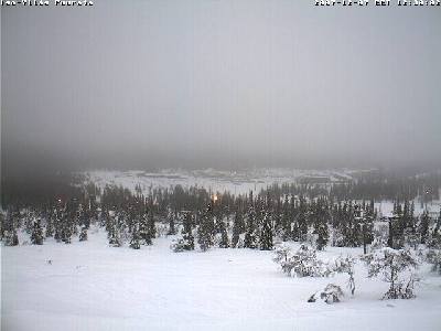
Ylläs Webcam
Ylläs Webcam

Fungal Positioning System

Note: This entry has been restored from old archives.

Walking, rambling, trekking… call it what you will, we do like a good long trundle. Alas, we don’t always have the time and energy left on the weekend for gallivanting. We didn’t make the best use of the, rather wet, summer here in the UK, but now that the occasional crisp sunny days of the colder months have arrived we’re getting out more.

A good while back, inspired by Antonio Carluccio’s Neal Street Restaurant and the subsequent addition to our library of his Complete Mushroom Book book, we became interested in the pursuit of fungi. This, combined with our fondness for wandering, has since inspired the collection of a few more books[1] and a serfish habit of walking with eyes downcast.

Amethysts In Hand
Amethysts In Hand

Now Autumn is well upon us and legions of fungi abound! However, we’re not yet so confident as to go merrily munching away at the bounty of the woods. That said, last weekend (Oct 7th) we saw some interesting specimens in woods south of Rickmansworth and we did net ourselves a good collection of Laccaria Amethystea (the common name is Amethyst Deceiver, one of my photos is to the right but this is a far better photo). These made a pleasant addition to the evening’s pasta. Yes, we picked bright purple toadstools and then ate them!

Over the weekend just passed we became more serious in our fungal pursuit. But now I shall significantly digress to the other subject of this post: GPS. Last week I was doing a little web-shopping, thinking to get a funky LED torch[2] and/or a couple of foldable knives (for fungus gathering). In the end I came away with neither item, having been lured off target by the glingy goodness of a fancy electronic gadget.

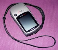
There are many GPS units around these days, with Garmin and Magellan seeming to have the best ranges for for the off-road trekker. In the end I picked a Garmin eTrex Vista HCx, the top of the line for the eTrex range, complete with the iffy features of an electronic compass and barometric altimeter (but hey, when buying a new toy you may as well get all the geekbling! gling?). The cost/benefit analysis of the purchase decision basically came down to 50 quid extra for the altimeter, compass, and high-speed GPS hardware (with the additional cost of battery life being 25 hours rather than 32). In the end I decided that for the cost of a reasonable dinner for two… why not?

Along with the Vista I have the official Garmin TOPO Great Britain map, a bloody expensive heap of bytes. At 100 quid from many UK sellers, it seems very expensive until you stop to think that it includes topographical and road data for the entire UK. Reflect on Encyclopaedia Britannica for a moment though, remember when they produced a CDROM version and tried to flog it for a four digit price? The digression digresses… It’s the great divide between, what I think of as, “the past” versus the new “digital product generation”. Shelves of encyclopaedias that you pay thousands of units of currency for have become an anachronism and I expect many parts of that industry were laid to rest by the “digital generation”. At a time when it seems even the empires of the media distribution companies may crumble, vendor lock-in can’t keep the likes of Garmin going for long. Tomorrow the capabilities of their eTrex will be in my phone[3] and Google Earth will be the only software I need as roving communities of GPS geeks build up their own databases of topographical data. Gah! Enough idle speculation, back to my digression.

Garmin Vista HCx
Garmin Vista HCx

In the short time I have had to play with my geek bounty I’ve been pretty impressed. The Garmin gets a lock damn fast and the GPS tracking against their map is impressively spot on, doubly impressive to see it map into Google Maps with high accuracy as well! (More on that in a moment.) At first the screen seemed rather small (3.3×4.3cm), but it does not inhibit use of the device as much as I expected (it is also surprisingly readable in daylight). The input interface is simple, using 5 buttons and a mini-joystick, it took a little learning but after a day in the field I didn’t have to think to operate it.

So, the downsides? Well, as per earlier rant, map data is very expensive. I bought this for UK trekking so the UK map was essential (and realise, if you prefer to pay for such things this will add 50% more to the price of a good unit). While, considering the content, I think the price isn’t unjustified I also think that it is a significant “hidden cost” that really should be better disclosed in the product description and specifications. Time for some more subdigression. A system when you could license, say, 100 square miles of map would be great for the trekker. By this I mean you’d have such a license and at any one time be able to load on at most 100 square miles from an online Garmin world-map database. For something like a 20 quid yearly subscription this would seem pretty attractive. It is probably prone to having the data ripped though, but that’s nothing new — as far as I can see you can already download unlocked versions of the majority of Garmin map products from various file-sharing systems.

The second point about the maps is: don’t get your hopes up. They’re nowhere near as good as the Ordnance Survey OS and Landranger maps. Consider it this way: a Garmin GPS unit with GB TOPO maps is a near-perfect navigational aid, but keep your trusty OS handy for the fine details. The up-side is that the topographic data on the GB TOPO maps is from the OS, so it matches perfectly and it’s easy to both home in on your on-paper location, and map a waypoint into the GPS based on OS map features. As far as I can work out the TOPO maps are the best you’ll get for the Garmin, I think trying to display all the OS data would be a UI nightmare anyway.

What else is wrong with the device? Well, I find the electronic compass to be too unstable, but I might just need to get more used to it. So far I’m not convinced that I’d want to use it to take a bearing. Now to my main gripe, the little research I have done indicates that Linux basically doesn’t exist in the world of Garmin. (Shock! Horror! Oh, poor me, the big bad company doesn’t care that I’m a technodeviant!) The Win32 MapSource tool that comes with the device is a bit clunky but actually does it’s job pretty well, letting you plot out courses to upload to the GPS device and download then edit tracks and waypoints saved on your trekking. (With the insane limitation that it cuts off waypoint names at something like ten characters, what decade is this!)

What can Linux deviants turn to? Well, some dude has done a great job on a tool called gpsbabel, this does the very important task of sucking data from the unit or from files saved in MapSource format and converting them into a variety of other formats. I have found that the process that works best for me is to download data from the unit in Windows/MapSource to tidy up the tracks and waypoints as necessary, then use gpsbabel to covert the data into the format I ultimately desire: Google KML. (gpsbabel works under both Windows and Linux.) Though the KML needs to be hand cleansed, otherwise Google Maps barfs on some parts of it, I haven’t had time to take a closer look at this.

I’ve had the eTrex Vista HCx for only 4 days, so it is still “early days”. I’m hoping to work out an acceptable all-Linux solution. This might be using gpsbabel to suck from (and load to) the device and “Google Earth” to edit and create tracks and routes. The $US20 per year version of Google Earth appears to support Garmin devices, that is certainly worth exploring. Unfortunately Google Earth stopped working for me when I upgraded my Ubuntu to gutsy (I’ll echo other people in the opinion that upgrading to gutsy was mostly a PITA, last thing I wanted was bloody geek wank like compiz), I’ll wait for the free version to work again before trying the Plus version. You can also edit tracks and points with the Google Maps web-application, but I find it too laggy. (Is is just me, or has Firefox become a slow piece of crud these days, I find myself using Opera more and more often now.)

As is the way of these things I have now written a lot more about the negative than the positive. Don’t be fooled! So far I’m very happy and impressed with the new toy, it was really very pleasant company on a couple of longish walks we did this past weekend.

So, fungus I said. Gus? Who’s Gus? (Gus is the name identifier I’ve loaded onto my GPS!)

Whippendell 20071020 Samples
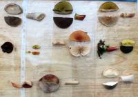
Fungal Specimens from Whippendell Woods

On Saturday October 20th, GPS in hand, we reprised our Whippendell Woods Walk — hunting fungi. Mapping the track from the Garmin into Google Maps left me rather impressed by both the accuracy of the GPS and the translation between the GPS and Google Maps. The trail comes up with enough accuracy to even be mostly on the correct side of the canal we followed (though often in the canal). We gathered 10 samples for later identification, which has proven to be a fun exercise. It’ll be interesting to see how long our little amateur-mycology hobby lasts. (Historically, I’m very bad at hobbies, the pattern tending to be an intense burst of focused interest shortly followed by complete and utter neglect.) The hardest part of fungus hunting is that we have an interest in finding stuff that is good to eat, gastronomic exploration is very much a part of who I am. But fungi are a bit of a dangerous minefield of creatures with names including words like “death”, “sickening”, and “poison” and on top of that we noticed this weekend that people had been through and really not treated the fungi very well. (There’s quite a bit of money in commercial harvesting of wild fungi these days, sometimes I curse the recent gourmet revolution driving up the scarcity and prices of things that used to be little-known delicacies.)

On Sunday we did a quick south-of-Ricky pub-ramble. Taking in the Ye Olde Greene Manne (nothing special, a chainpub) and the Rose and Crown (pretty good pub).

I intend to write more about both walks… though, as ever, such intentions go onto the pile with the likes of writing about some call graph visualisation I explored recently, several noteworthy places I’ve eaten at, some good coffee houses, some interesting books… the list goes on.


[1] The Encyclopedia of Fungi of Britain and Europe by Michael Jordan (excellent but rather large for trekking); Field Guide to Edible Mushrooms of Britain and Europe by Peter Jordan (not related); Collins Gem – Mushrooms by Patrick Harding (ultra mobile).

[2] The LED Lenser V2 Professional seems rather nice, though I have read some less than positive comments about the LED Lenser products.

[3] You should see the technogeek lolly goodness available (or soon to be) in Japan, the likes of: OLED display watches with 4GB storage for audio and video; normal sized mobiles with wifi and GPS; self-milking genetically engineered digital cows that you can keep in the fridge and that live on old food that otherwise might evolve

Bastia, Corsica (France)

Note: This entry has been restored from old archives.

Basita has a much more relaxing and interesting feel to it than Nice, though I didn’t think much of Nice in general. Too much city, too much fashion, too smelly. Corsica I’ll do again. Prior to Nice, Provence was great with the Verdon Gorge being a particular highlight. It’s not the best region for wine if you’re into full bodied reds though, it’s really rosé country, there are a few decent reds around though (maybe more on that later). The lowlight of the trip was on the last day with the hire car… I went over what I guess was a pot-hole and managed to get two flats simultaneously! The Europecar mechanic, called out on a Bastille public holiday Saturday, was, luckily, highly amused.

In a couple of hours we board our ferry to Livorno, a four hour crossing, from Livorno we head to our hotel in Pisa (train, 15 minutes in theory). Just one night there before a very early train to Rome. A bit of a whirlwind pass through Bastia and Pisa really.

The weather is a pleasant ~30 degrees, a little humid at times, clear and sunny all the way.

Contrary to popular belief rather few people in shops/etc in France (outside of Nice) seem to speak English. But we get by OK, Yaël with her 6 years of French doing much better than me with my 3 years of not really liking French class! That said, most young people in bars and cafés do speak English well (in one case with a rather stuffy pommie accent). Ah, the eternal shame of the monolingual… maybe Kat and I can get focused on that Italian!

The bank blocked my CC yesterday, a red-flag for fraud. Joy. But I’m happy that these systems are in place. Just remember to travel with more than one card 🙂

Back to the UK on Saturday, we can spend Sunday sorting (discarding) our 1000+ photos, then back to whatever work is up to on Monday. The Lumix DMC-LX2 has been serving me well, certainly glad I got the 4GB card. Even with that we we just had to move a whole bunch of photos to a 2GB USB stick I had the foresight to bring with me. I expect Rome to be photo-heavy, Yaël with every Roman sight available.

Fly Away Home

Note: This entry has been restored from old archives.

My commitments (work, work, and some work) will finally permit me to head back to Australia for a little while. A week each in WA and Sydney — so Kat and I can spread our time evenly with our respective families. Our itinerary is:

  May 27th: LHR to PER: Arriving Mon 28th 14:10
  Jun 03rd: PER to SYD: Arriving Sun 03rd 16:00
  Jun 10th: SYD to LHR:  Leaving Sun 10th 16:40

I’m proposing a call-to-drinks on Monday the 4th of June, being a “school night” it’ll be an early one. If you can come along I’m sure it’d be great to see you, whoever you are 🙂 I don’t know where it’ll be yet, but I’m thinking The Australian up in The Rocks is a good choice (but I might make it closer to Sensory for after-work convenience — or somewhere quieter just to keep it relaxed).

But wait, there’s more. I think a more lively call-to-drinks needs to be set up for Friday the 8th as well! Again, it’d be great to see anyone there who can make it. This will probably be at the James Squire Brewhouse at Darling Harbour.

I’ll also be going to the Little Creatures place (noticing a theme?) in Freo during my WA week, but I expect that’s a little out of the way for most people I know!

There’s much to celebrate: being in Australia for one (though we missed the damn summer), catching up with everyone we haven’t seen for a year, Kat and I starting out on the route to becoming Poms (we have company-independent residency visas now), Kathlene getting a job within a month of getting a visa!, not to mention various great events in the lives of our friends “back home”.

I’ve heard from a reliable source that there might be “something happening” on the 9th as well.

Aside from these tentative plans I’ll be in Sydney for that whole week (albeit based in the far and distant land of Kellyville) and on leave for most of it. Lunches (ah, Ten Buck Alley), coffees (ah, Toby’s) and the like are all open.